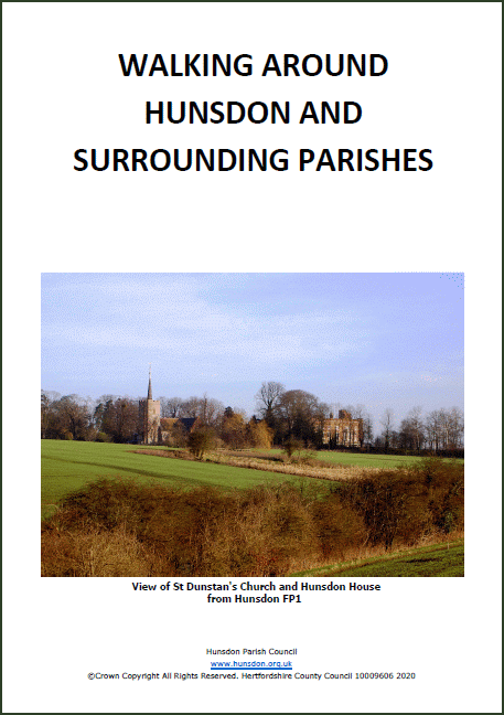
Walking around Hunsdon’s public footpaths has always been popular. But at lockdown time it has been even more beneficial.
Hunsdon is fortunate in having public footpaths throughout the parish. Many of these can be traced back, probably several hundred years or more, conforming to old field boundaries and routes between the adjacent villages and hamlets long before the road system as we know it today came into existence.
The Parish Council is keen to see residents use this unique facility and has been a member of the Hertfordshire Parish Paths Partnership since 1999. This is a partnership between the County Council Environment Department and their team of Countryside Access Officers, together with its associated Countryside Management Service and the Parish Councils.
To help with your walking options, the following suggested walks are taken from the booklet “Walking around Hunsdon and Surrounding Parishes” by John Ashley MBE, a past Hunsdon resident. In addition, the complete network of public footpaths in Hunsdon and Eastwick & Gilston parishes is shown on a separate fold-out map. Copies of both are available at Hunsdon Village Stores, The Fox and Hounds, The Crown, Hunsdon Garage, Rosemary Cottage Acorn Street, 28 Wicklands Road (in the porch) and at 1 Hunsdon Farm Cottages, Church Lane.
Each walk has a link to the relevant attached .pdf file which includes a map and detailed description of the walk. A Google Map App of all footpaths and Rights of Way in Hertfordshire can be downloaded at the following Herts County Council website:
hertfordshire.gov.uk/services/recycling-waste-and-environment/countryside-access/rights-of-way/current-rights-of-way/the-definitive-map.aspx
Short Walks
Longer Walks
The complete booklet of walks can be viewed and downloaded here Easy Access Routes |
This book has been produced by Hunsdon Parish Council using grants from East Herts. Council’s Local Environment Action Fund and the Parish Paths Partnership Scheme. The Parish Paths Partnership is administered by the Countryside Management Service under the direction of Hertfordshire County Council and Hertfordshire Association of Local Councils. |
|
| Identification of paths Each of these categories of paths are given a separate series of numbers applicable within the respective parish. To aid in identification a prefix letter, as shown below, has been added before the path number
E :- Eastwick and Gilston |
Map key to Rights of Way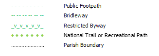 |
|
Parish Paths Maintenance
The Parish Council appoints a footpath warden who is responsible for monitoring the condition of the Public Footpaths within the parish. Any maintenance matters are reported to Herts County Council Rights of Way Service for remedy. If you encounter any issues on your walks please contact the warden, currently Bud Carthy at 01920 872597 or Hunsdon Parish Council via the parish clerk.
Some of your responsibilities when using Public Rights of Way
- Keep to the Right of Way and do not trespass on other land.
- Keep your dog under control and remove any dog waste
- Use gates and stiles to cross fences hedges and walls – remember to leave any gates as you find them.
- Take special care where part of your route involves walking along country roads.
- When using paths across the former Hunsdon Airfield be aware of the movement of heavy machinery using the internal roadways and low flying aircraft using the microlight airstrips.
Signs you will see on your walks
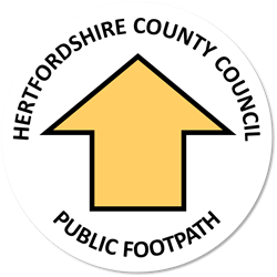 |
Public Footpath (FP) for use of pedestrians only | 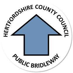 |
Bridleway (BR) which can be used by horse riders, cyclists and pedestrians | 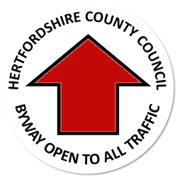 |
Byway Open to All traffic (BOAT) | 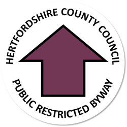 |
Restricted Byway (RB) can be used by pedestrians, horse riders, cyclists and non-motorised vehicles |
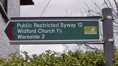 |
‘Finger’ sign, post mounted at the point where the right of way commences from a public road. Generally shows the status of the path, its destination and distance to that point | ||||||