Below is plan of the lower (new) churchyard at St Dunstan’s which has been used since the 1940’s. Unlike the upper churchyard we have good records of the names of those buried, or whose ashes are interred there. However we are keen to collect and share more information about those past and would invite anyone who can contribute to send information to website@hunsdon.org.uk so the information can be added to our database. Please include your name, address and a telephone contact for future reference.
To search the database type in a grid reference or the surname of someone you think might be in the churchyard on the following form. (Tip Try just a few letters of the name – eg ‘Sm’ rather than ‘Smithers’ – in case the spelling has changed over the years).
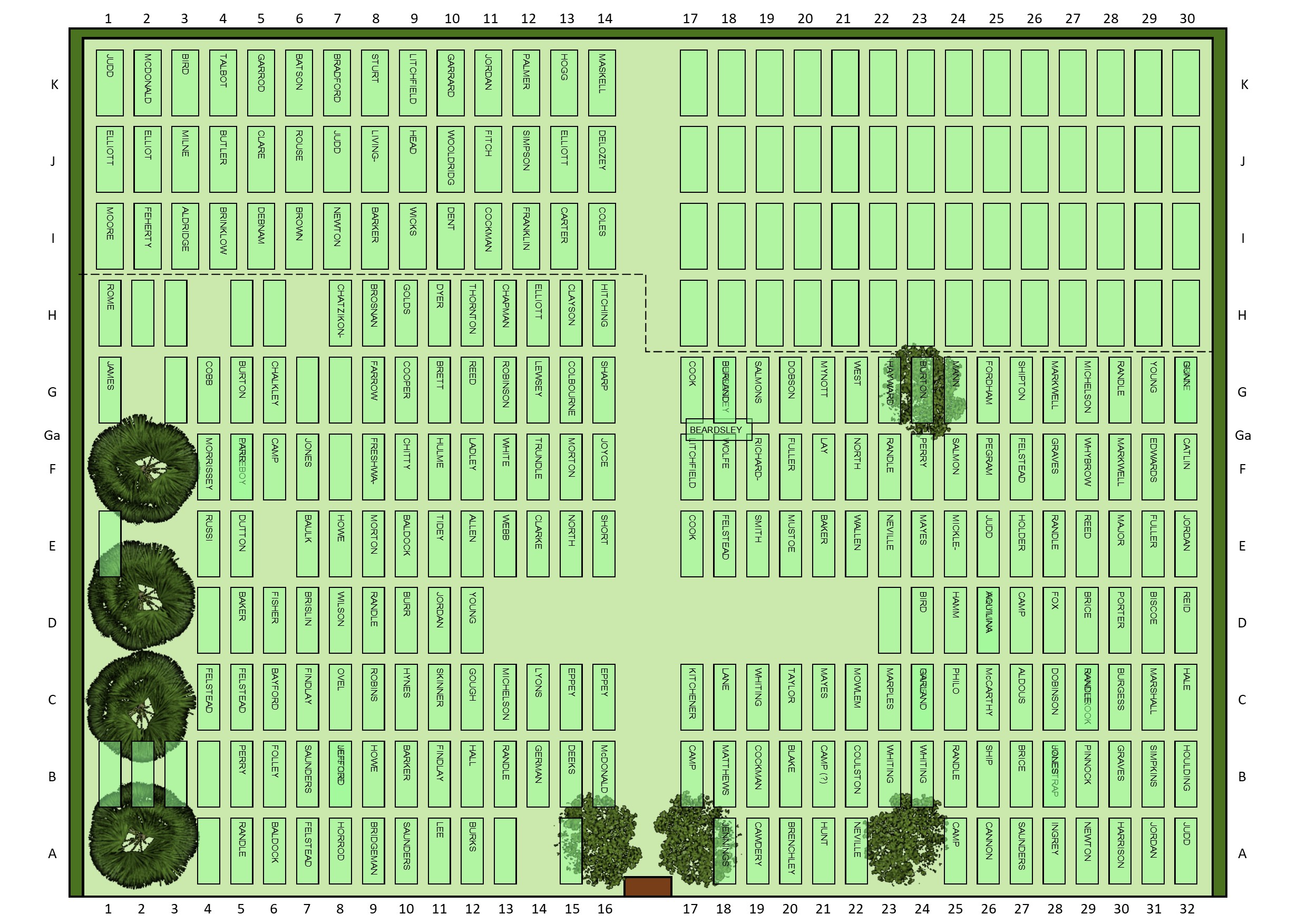
In many cases more than one family member is interred in the plot – the results will show all of the family associated with the grave. Click on the thumbnail to see a full-size photo of the plot. If there is no thumbnail then you should assume there is no memorial or other marking. We have taken care to ensure the information on this website is as accurate as possible, however much of the information has been taken from incomplete and handwritten records. Should visitors identify any mistakes such as spelling of names, plot location, dates and ages of the interred etc, we would be pleased to be notified so that we can amend the records.